Territory knowledge
that doesn't fade.
TerritoryBoard turns territory familiarization into a drill your crews will actually run — a live map on the station TV, a controller in every firefighter's hand, and a score for every road, landmark, and hydrant across your department's full coverage area.
Nobody drills on the map
until it's the wrong day to learn it.
New hires get a folder of maps, a few ride alongs, and whatever their engine company happens to pass on shift. Annexations, new cul de sacs, and renamed roads outpace anyone's memory.
Veteran crews aren't immune either. Plenty have driven the same streets for years without ever deliberately learning the district — or they knew it cold once, and without anything to keep it fresh, it slipped.
None of that shows up until a call comes in on a street nobody's driven — and hesitation on scene costs the minutes territory knowledge is supposed to save.
TerritoryBoard replaces the folder with an interactive digital map: a drill and a score every crew can see improve, station by station, shift by shift.
One board. Two screens.
Every road accounted for.
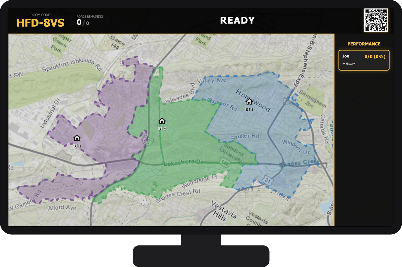
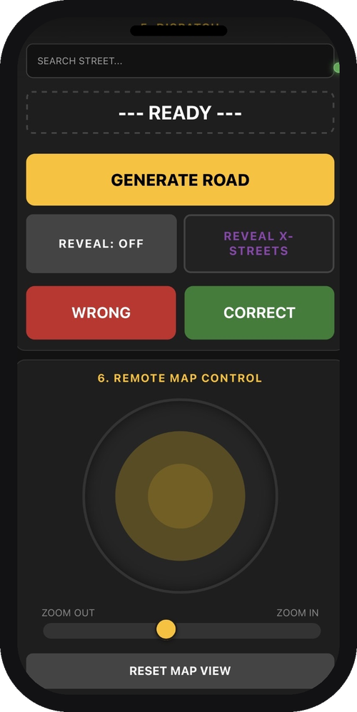
A TerritoryBoard station pairs a wall mounted TV with a live, interactive map of your department's territory and a phone controller for each crew.
Set the room
Each station gets its own room code. Crews join from their phones; the wall TV shows the shared map. Nothing bleeds between stations or departments.
Call the play
A firefighter searches for a road, picks a landmark category, or calls for a route — right from their phone, no touching the TV.
Board reveals, crew scores
The TV highlights the answer, draws the route, and shows nearby hydrants. The crew marks the call correct or incorrect together, right there.
Builds each firefighter's record
Every call logs to that firefighter's own profile — showing strengths and weaknesses so they can train more efficiently, and a record that can help document mandated training hours.
Built from your department's
own data, not a generic map.
TerritoryBoard is built per department, from your own GIS and hydrant data — not a stock map with your logo on it.
Road & landmark ID
Crews are quizzed on street names and points of interest across the department's full coverage area, not just the streets near quarters.
Route It
Reveals the actual drivable path to a road, turn by turn, on the map — not just where it is, but how you'd get there from the station.
Hydrant reference
Hydrants near the revealed road appear automatically, status color coded, sourced straight from your department's own hydrant records.
One room per station
Every station drills independently with its own room code and talking stick turn order, on one shared department deployment.
Training records
An admin dashboard tracks sessions and scores per firefighter, over time — a standing record for mandated training hours.
Drive ModeIN DEVELOPMENT
Steer a virtual apparatus down real streets from your phone to reach a quizzed address, scored on route efficiency.
Homewood Fire Department
Homewood was TerritoryBoard's first live deployment — the department the platform was built with, station by station. All three of its stations run the board today, each with its own room code.
Bring TerritoryBoard
to your department.
Tell us how many stations you run and what mapping data you already have. We'll walk you through a demo and put together a quote.
Email us